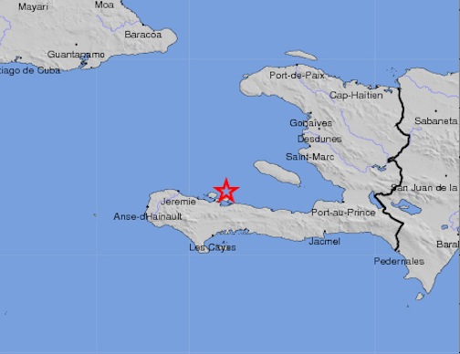
Above: a map of the quake (graphic: United States Geological Survey)
By the Caribbean Journal staff
A 4.5-magnitude earthquake struck northeast of the coast of Les Cayes, Haiti on Friday evening, according to data from the United States Geological Survey.
The epicentre of the quake, which occurred at around 9:11 PM local time in Haiti, was around 16 kilometres northwest of Petit Trou de Nippes and 51 kilometres north-northeast of Les Cayes and around 134 kilometres west of the capital of Port-au-Prince.
There were not yet reports of damage or injuries, although there were reports of slight shaking in downtown Les Cayes and other areas.
It struck at a depth of 6 kilometres.
As a point of comparison, Haiti’s devastating 2010 earthquake was a 7.0 magnitude on the Richter scale.
Friday’s was the latest in a string of recent earthquakes of similar magnitude in the wider Caribbean region, from Cuba to the north to Trinidad to the south.


