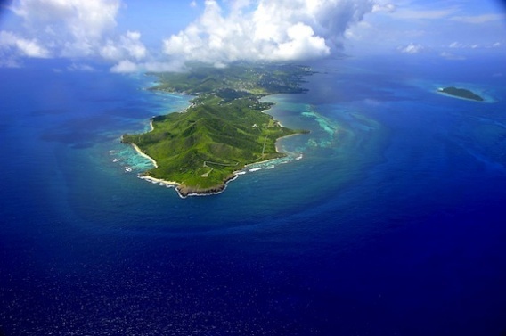
Above: the USVI
By the Caribbean Journal staff
As last week’s earthquake in Puerto Rico reminded, the Caribbean is a seismically active region — and particularly the northern Caribbean.
That’s led the US Virgin Islands to debut its first-ever tsunami evacuation map, which covers St Croix, St john and St Thomas.
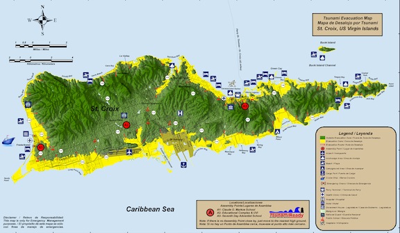
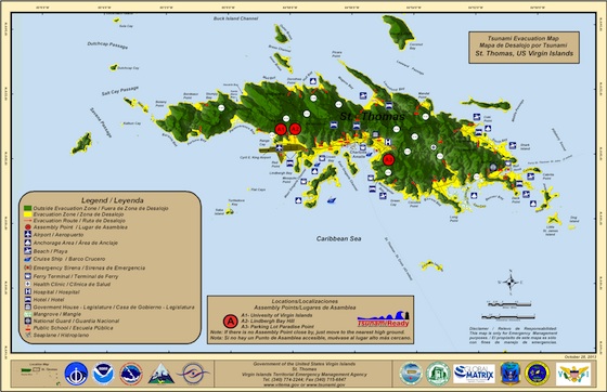
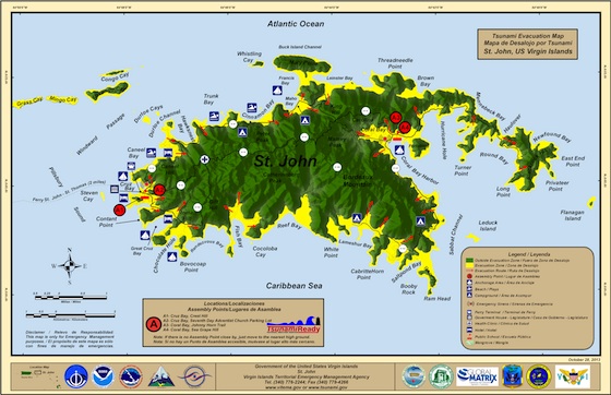
The maps “delineate coastline inundation in the event of the Territory is impacted by a tsunami, as well as safe areas, evacuation route directional arrows, assembly points and denotes public schools and other public facilities within the inundation area,” according to a statement from the office of Governor John de Jongh.
Above: the St Croix evacuation map
“VITEMA is proud to announce the availability of the Territory’s first Tsunami Evacuation Maps for the islands of St Croix, St John and St Thomas,” said Elton Lewis, director of the Virgin Islands Territorial Emergency Management Agency.
Above: the St Thomas evacuation map
The maps were created with the help of an $18,000 grant from the National Oceanic and Atmospheric Administration.
Above: the St John evacuation map
The territory will soon be launching a public education programme that will include town hall meetings and map distributions.
VITEMA has also applied to the NOAA’s National Weather Service to be certified as a “TsunamiReady” community.
“All of this effort led to building awareness of tsunamis,” de Jongh said. “Today we’ve laid the groundwork not only for our residents and businesses to be ready, but to be resilient.”


