News
Haiti Experiences 4.6-Magnitude Earthquake Southeast of Port-au-Prince
By: Caribbean Journal Staff - March 7, 2012
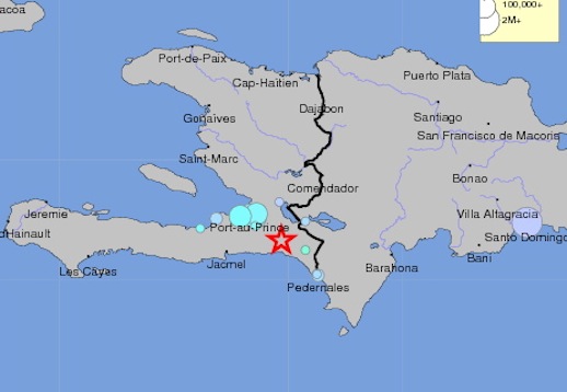
Above: the location of the quake (Graphic: USGS)
By the Caribbean Journal staff
A 4.6-magnitude earthquake shook Haiti on Wednesday night, according to a report from the United States Geological Survey.
The quake’s epicentre was located 37 km southeast of Port-au-Prince and about 140 km south-southeast of Gonaives with a depth of 4km.
It was an unwelcome reminder of the devastating earthquake on January 12, 2010 that registered a 7.0 on the Richter scale.
According to the USGS’ response-tracking system, it was felt most in Port-au-Prince and Petionville, and even as far as Santo Domingo in the Dominican Republic.